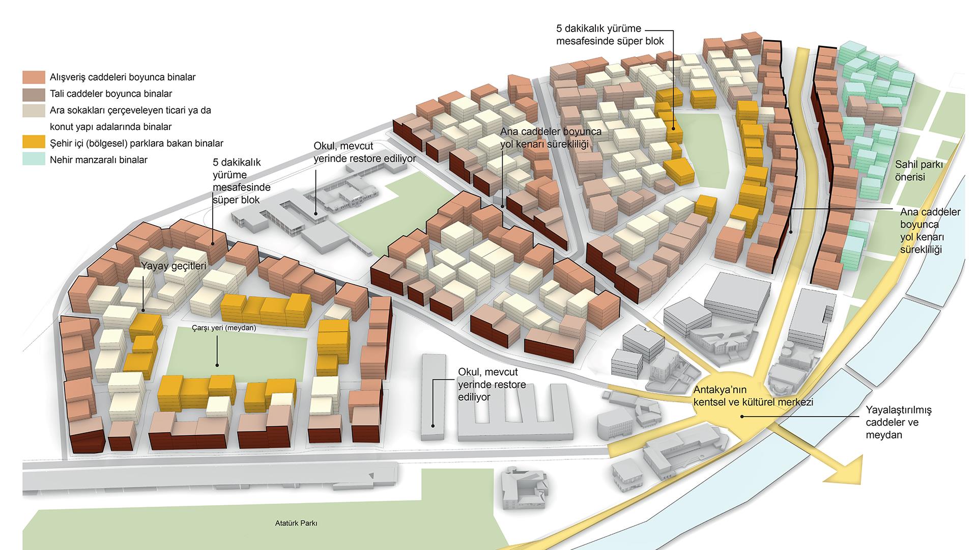
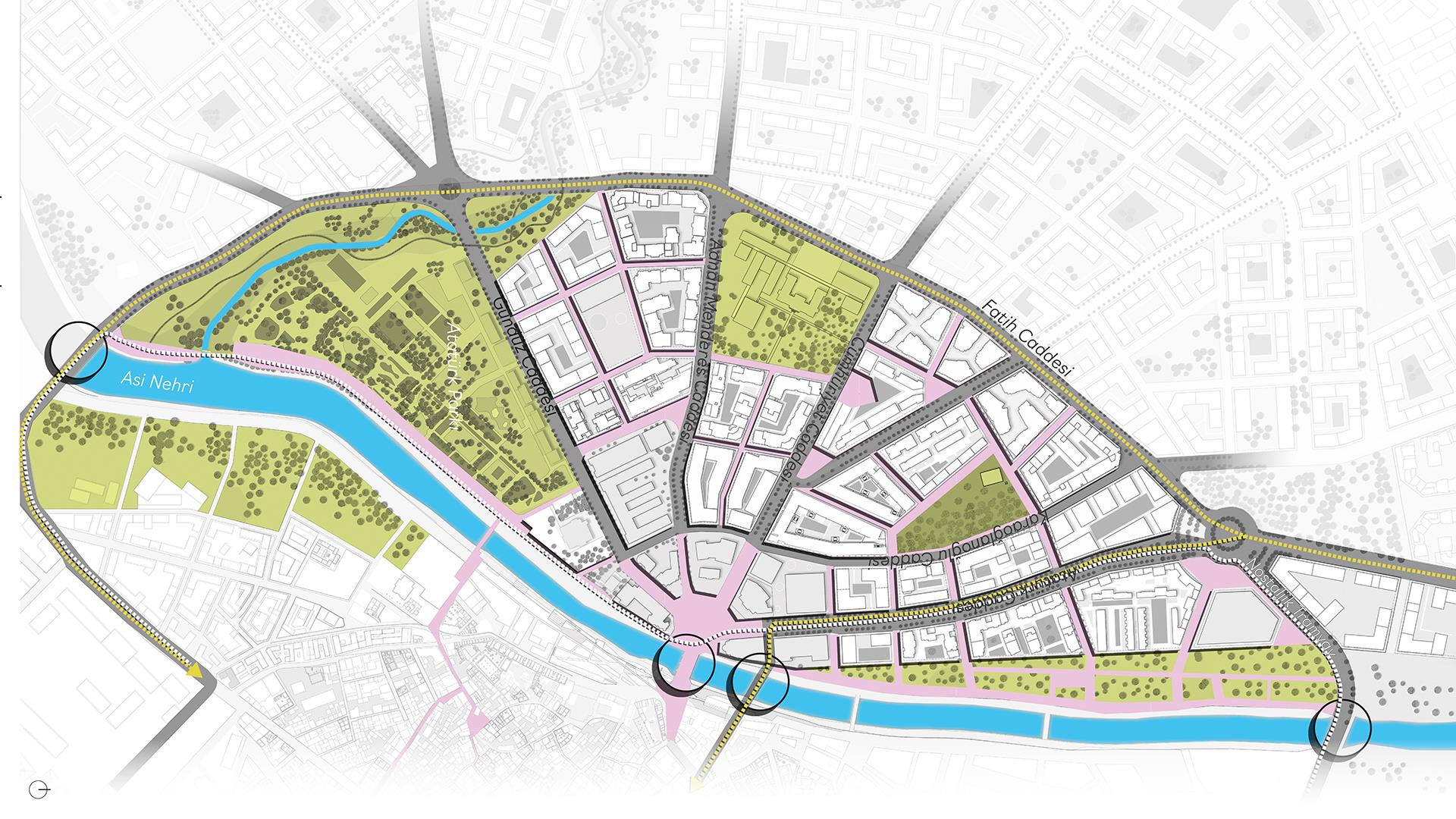
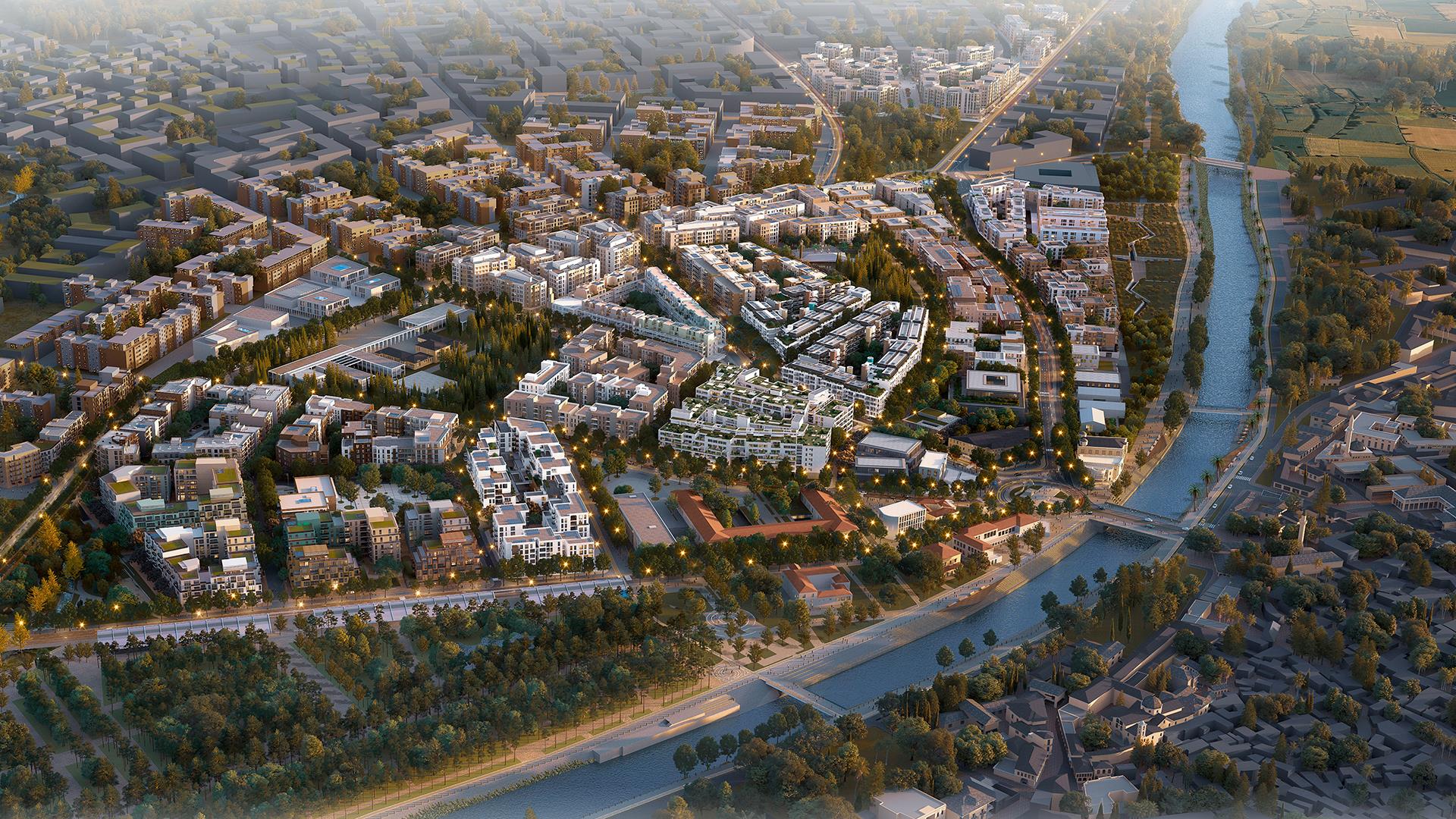
MASTER PLAN

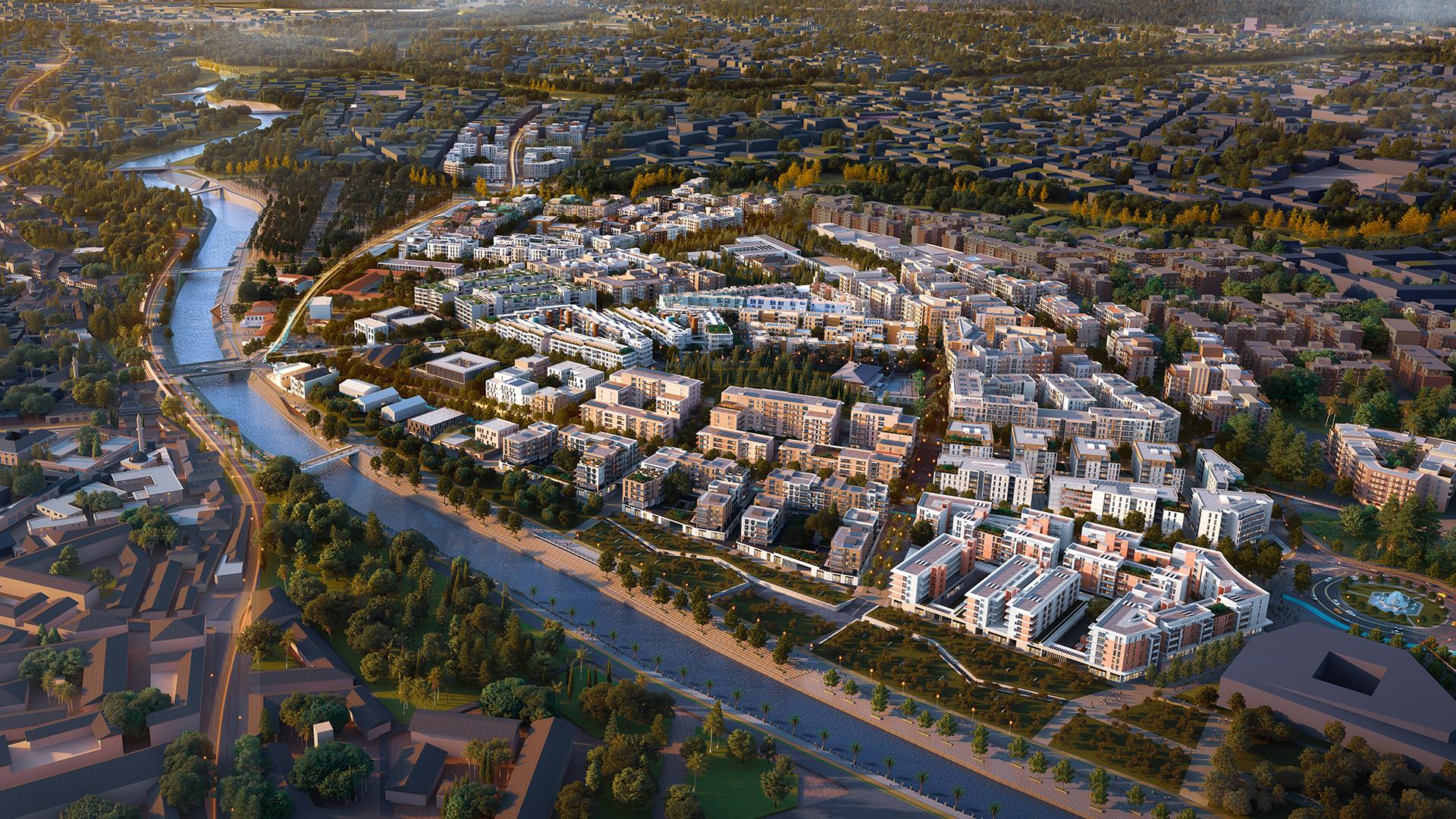
“Antakya, which takes its roots from the character of the old city, increases mobility and the quality of public space, and rebuilds with urban resilience and sustainable infrastructure.”
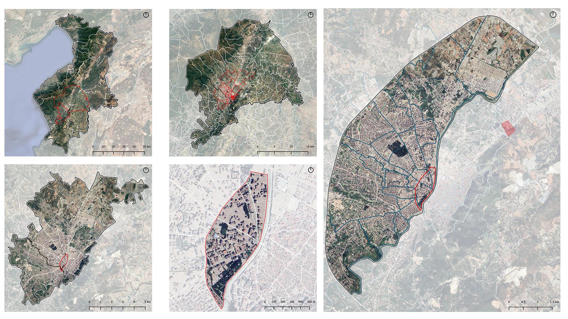
History of Hatay
Hatay is one of the oldest settlements in Anatolia. Historical life findings in the region date back to 100,000 BC. The first Bronze Age settlements have been identified and architectural remains have been found in Çatalhöyük, Tel Tainat, Tel Cüdeyde and Tel Atçana in the Amik Plain. Hatay’s history, geography, cultural patterns and social structure have created a multi-layered city character over the years and have always attracted people with its unique structure.
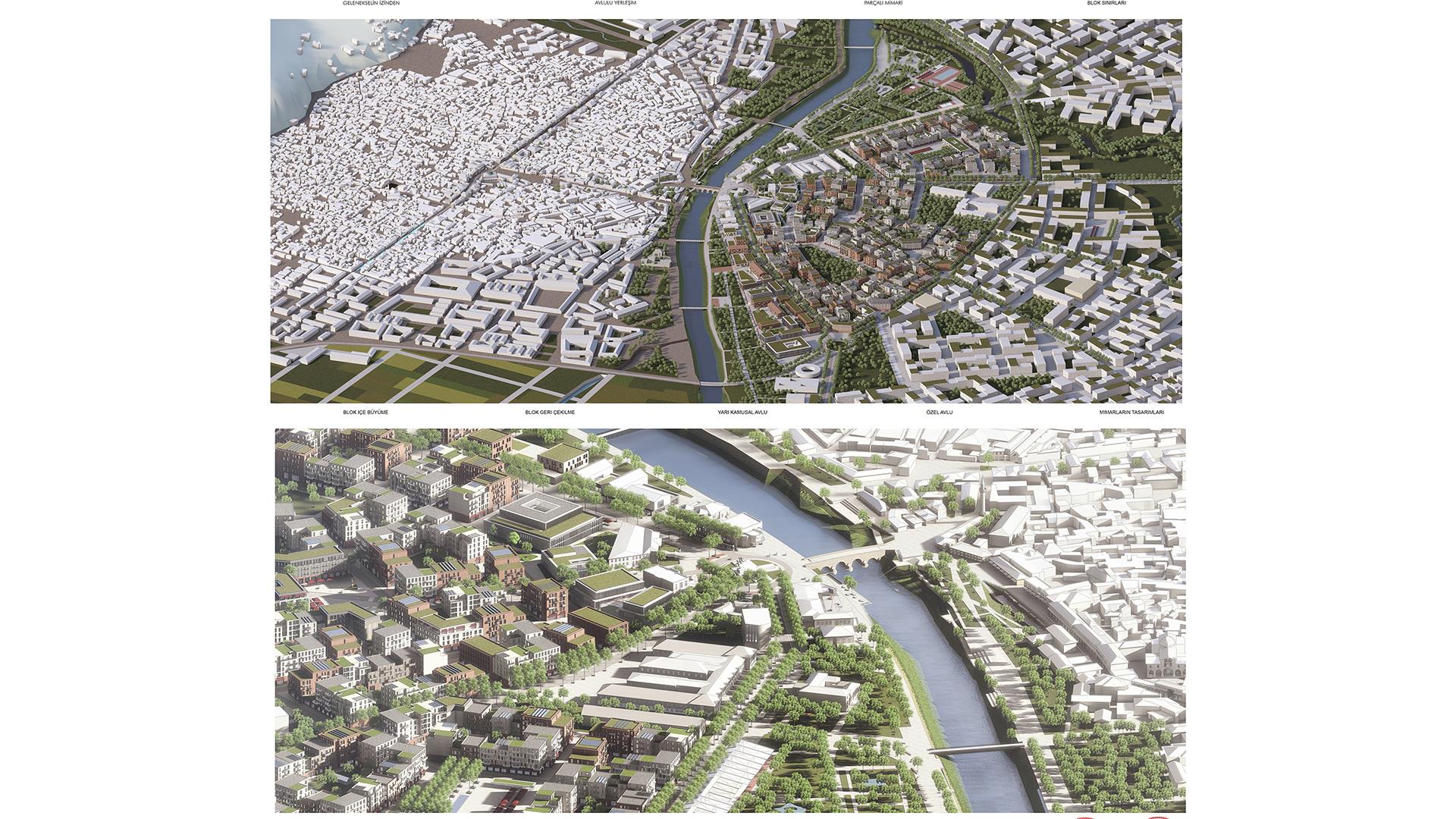
Due to the fact that Antakya is both a border city and a region that carries out activities in the field of agriculture and industry, it has been in the position of a trade centre. There are bazaar areas that have existed since the past to support trade in the city. As you go inland from the city centre, the change in the urban form of Antakya over time has been in the form of the deterioration of the linear and compact structure in the Ancient Period and the emergence of small and different building urban blocks.
In this project, which was initiated for the revitalization of Hatay after the February 6th, 2023 Kahramanmaraş earthquake, these potentials of the city have been examined and a sustainable vision has been adopted aiming to transfer the traces to future generations.
Pre-Earthquake Situation Assessments
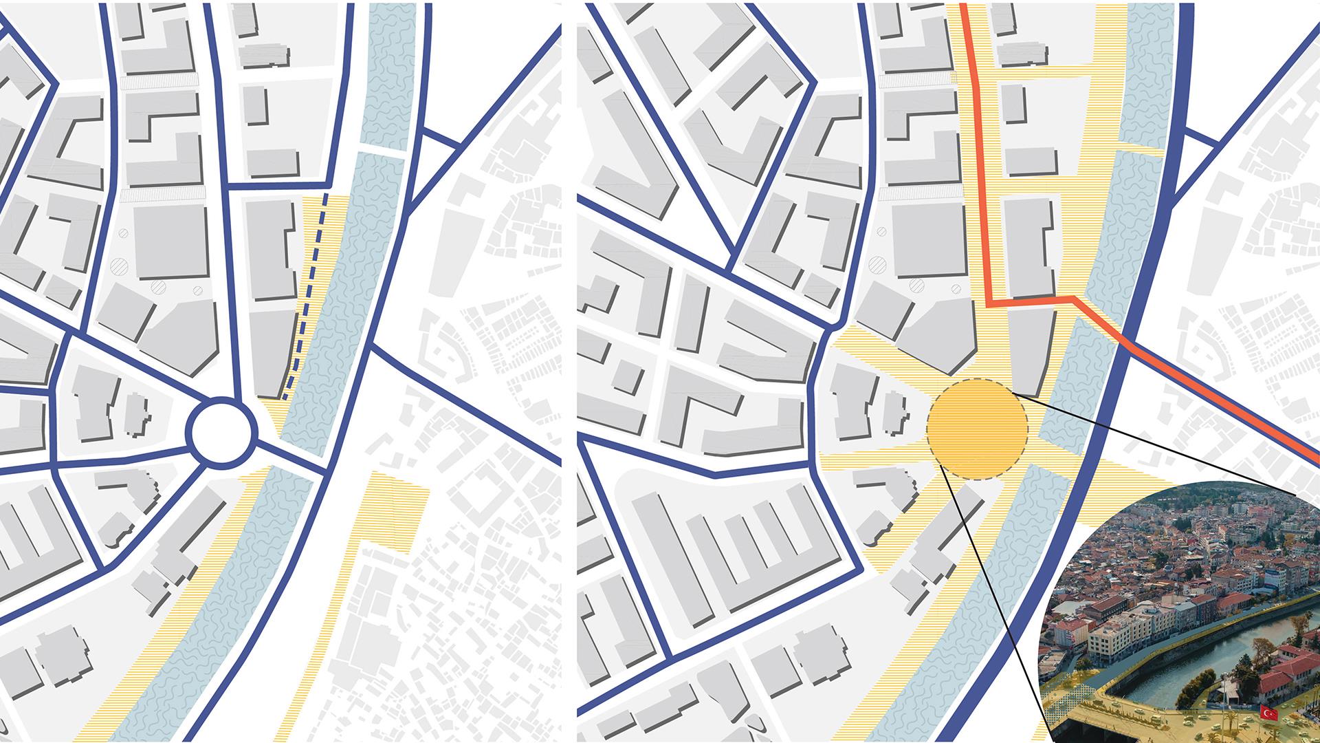
Hatay province is a multi-layered and multicultural city. The city, which has hosted many civilizations from the past to the present, attracts with its natural structure as well as its cultural structure. Amanos and Habib-i Neccar Mountains are the most important topographic thresholds affecting the settlement in the city. Transportation decisions are also shaped according to topographic thresholds. The rail system, on the other hand, is limited to the railway that reaches the port in Iskenderun district. The other threshold is the Orontes River, which forms the southern boundary of the Amik Plain. Since the establishment of the city, residential areas have been chosen near the Orontes River. The settlements on the coastline have developed together with tourism and fishing activities. The fact that the dominant wind direction of Hatay province is south provides air circulation in the city by providing air conditioning comfort. Although the fertile lands of Hatay province provide agricultural wealth, it poses a danger in terms of settlement. The province, which has alluvial soils, carries the risk of soil liquefaction. Active faults that connect to the East Anatolian Fault Line pass over the city.