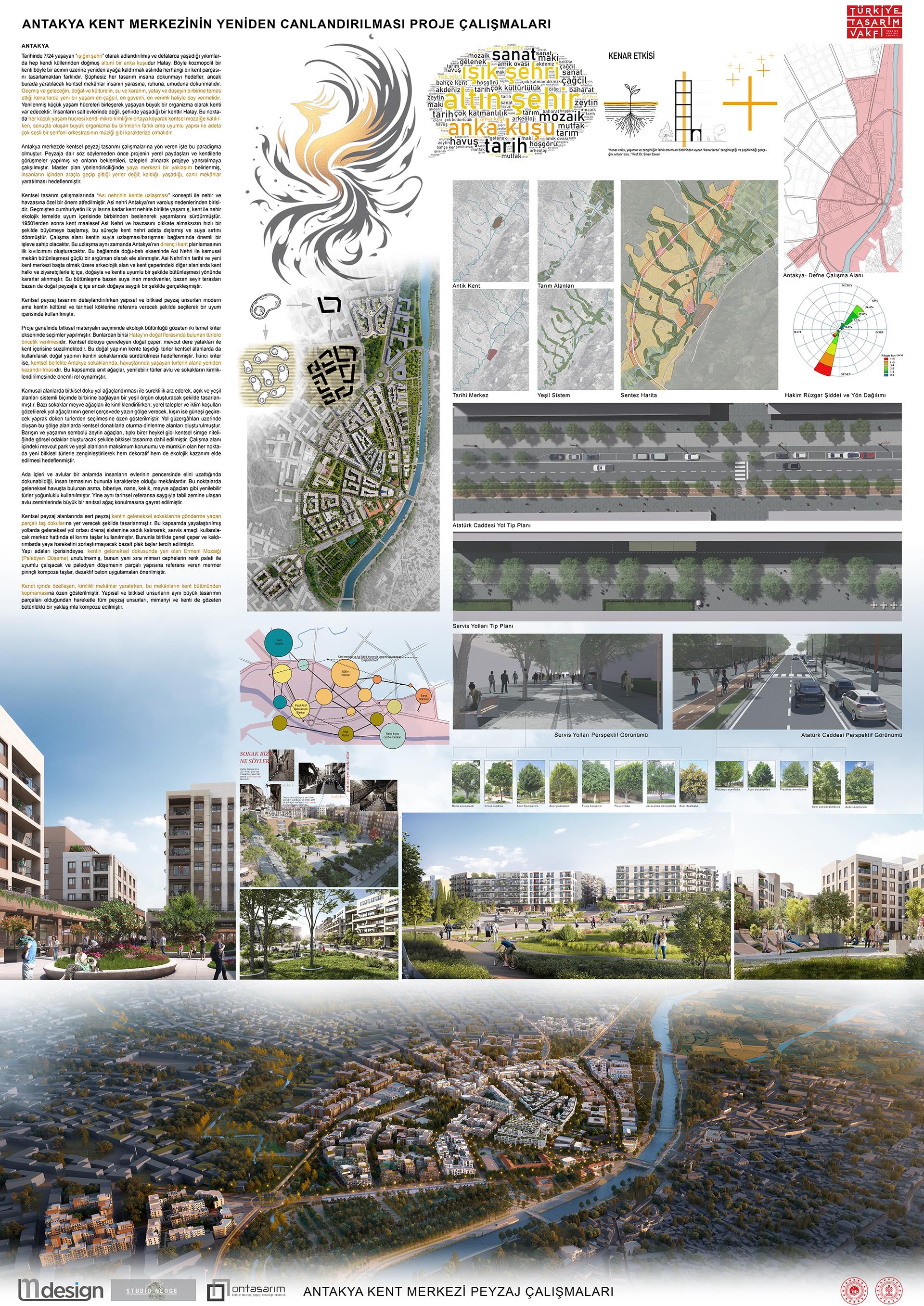
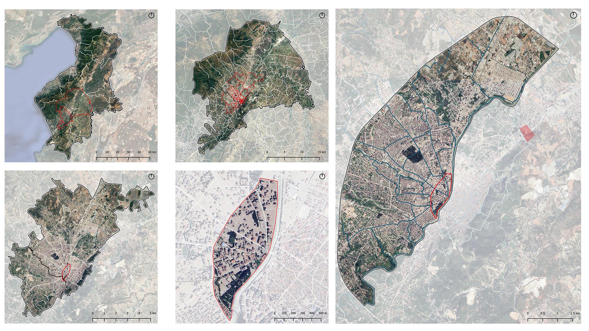
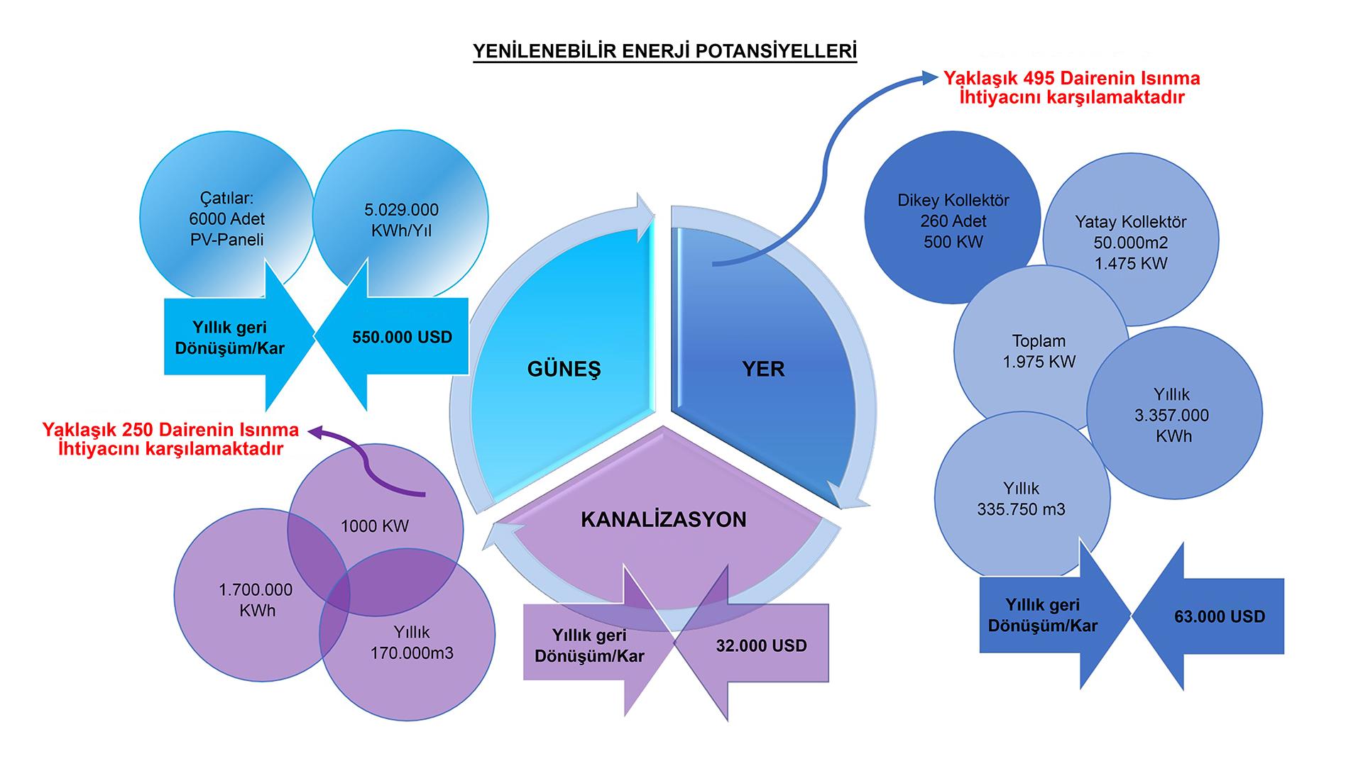
URBAN LANDSCAPE WORK

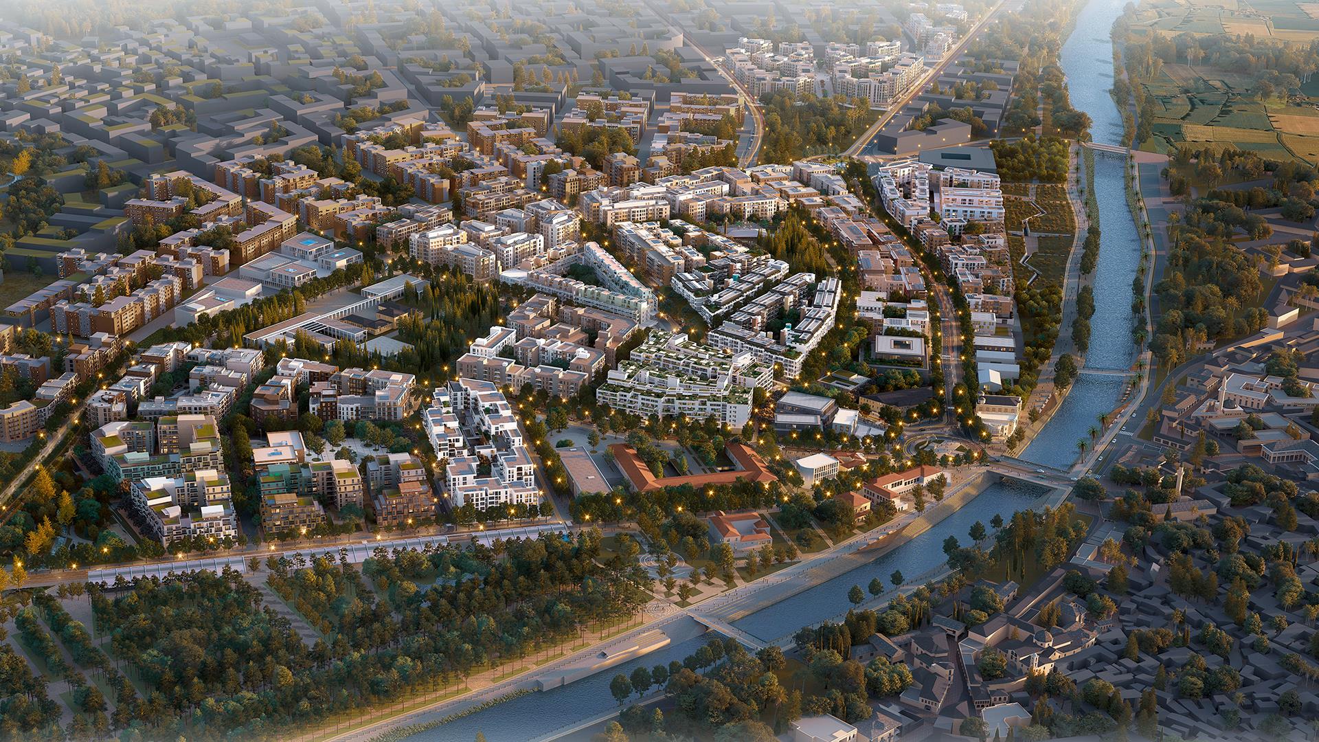
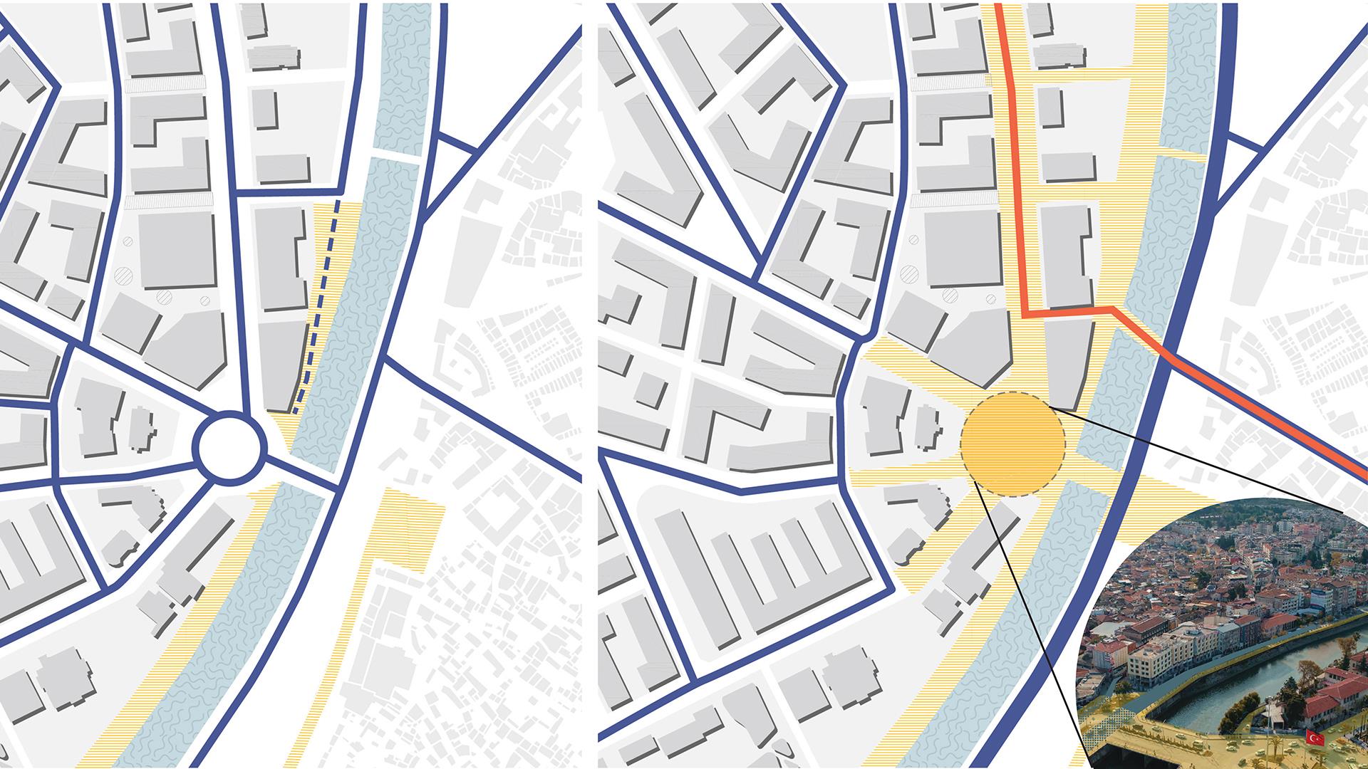
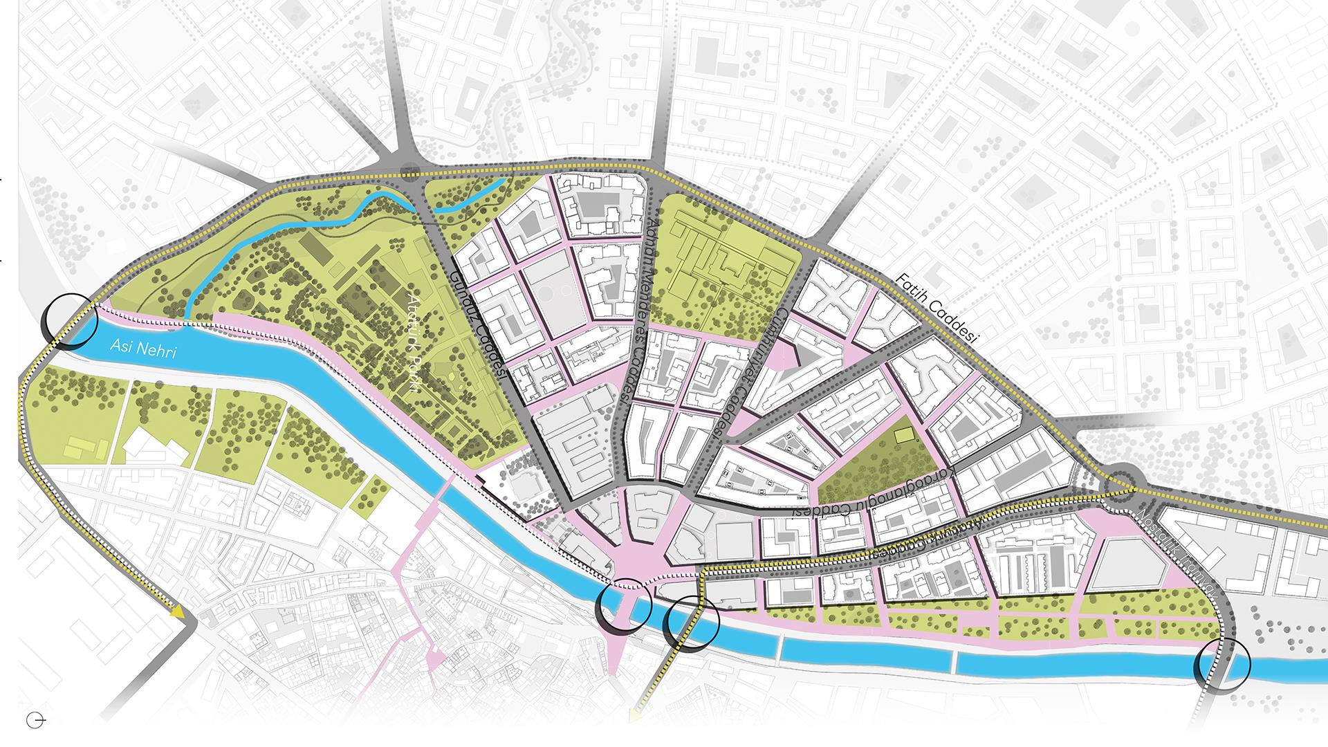
The Orontes River is one of the reasons for being of Antakya. From the past to the first years of the Republic, the city lived together with the river, and the city and the river continued their lives by feding each other in harmony on an ecological basis. After the 1950s, the city unfortunately started to grow rapidly without taking into account the Orontes River and its basin, and in this process, the city almost excluded the river and turned its back on the water. The work area will have an important function in the context of reconciliation/ pacation of the city with water. This reconciliation will also be the first spark of Antakya’s resilient urban planning. In this context, the integration of public space with the Orontes River on the east-west axis has been considered as a strong argument. Decisions have been taken to integrate the Orontes River in harmony with nature and the city, intertwined with the people of the city and visitors, in the archaeological site and other areas on the Wall of the city, especially in the historical and new city center. This integration has sometimes taken place in a way that is intertwined with the stairs leading down to the water, sometimes with the observation terraces, and sometimes with the natural landscape, but respectful to nature.
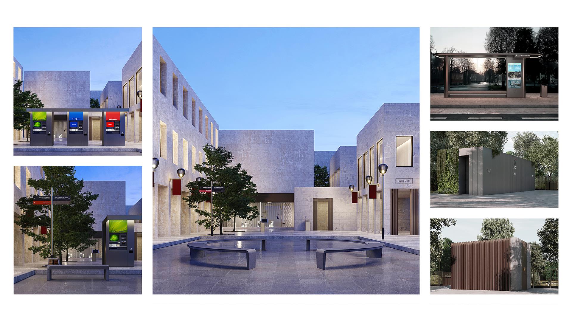
Landscape Design Decisions
In order to provide shade along the Square and the River, planting consisting of natural plant species of the geography has been proposed. Care has been taken to select the plants used from natural species that use less water. The number of trees has been increased in public areas and along the river, with particular emphasis on shade-giving species. Trees that provide shade were used in the seating and viewing areas along the river line and on the slopes. Thus, a green backbone was created that continues along the city center with the Historical Atatürk Park grove. The roads and building islands that make up the grid plan of the historical city were designed by the architect Xenarius with dimensions of 56 m x 112 m. This measure has then become the city’s urban planning standard. In the study area, floor sections were determined using the proportions of this measurement. Likewise, the same ratio has been maintained in carriageways and other pedestrian areas.
Anı Park
It is an area dedicated to those who lost their lives in the February 6th earthquakes. The design is based on the fissure created by the earthquake. The names of those who lost their lives are engraved on the memorial wall that runs along the crevasse. In Anı Park, a very calm landscape approach has been adopted, and olive trees have been proposed in memory of those who have disappeared.
Atatürk Park
It will be absolutely protected as a cultural landscape value. A landscape restoration is proposed here. Landscape restoration will be carried out without changing the existing floor material in any way without damaging the existing texture. Pedestrian axes at the gridal level will be integrated with the Orontes River. The museum district is designed as a contemporary culture and art center between the museum used today and Atatürk Park and the new city square. The buildings of the Governorship and the Provincial Directorate of Health will be transformed into the Antakya Architecture Museum as a whole. The perimeter walls of the buildings will be removed and integrated with the Orontes River, so that the new backbone where be held will be integrated with the Atatürk Park recreation system.