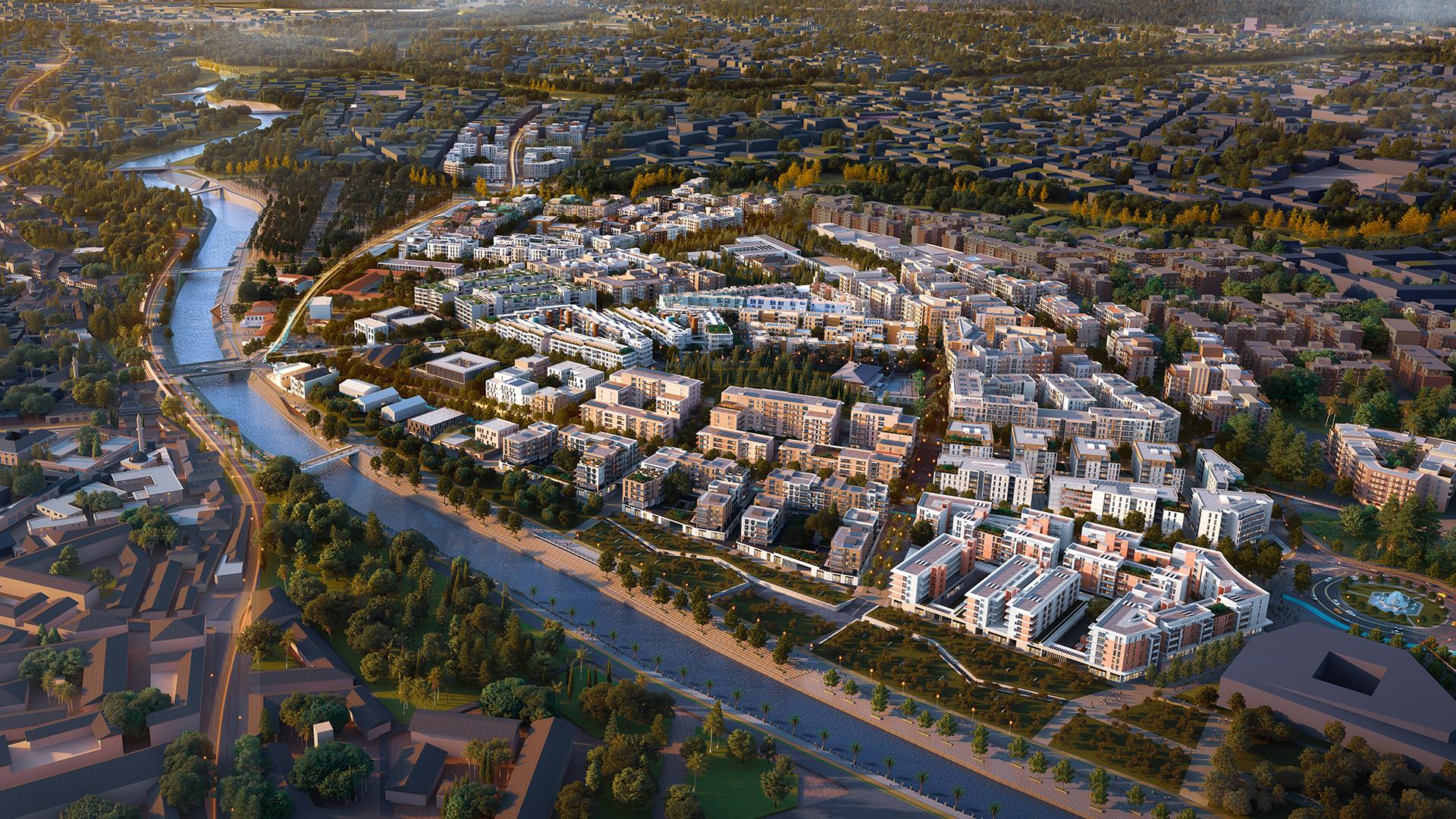
MASTER PLAN

Analysis: Urban Approach and Principles
Our aim for the master plan is to pursue an evidence-based approach, that draws from research, experts and the input of the local community.
The design borrows from the city before the earthquake in terms of scale, spatial structure, and strives to reinforce its local character and climate resilience.
The design also enhances accessibility and inclusivity, through the creation of new public green spaces, efficient transportation systems, and community hubs.
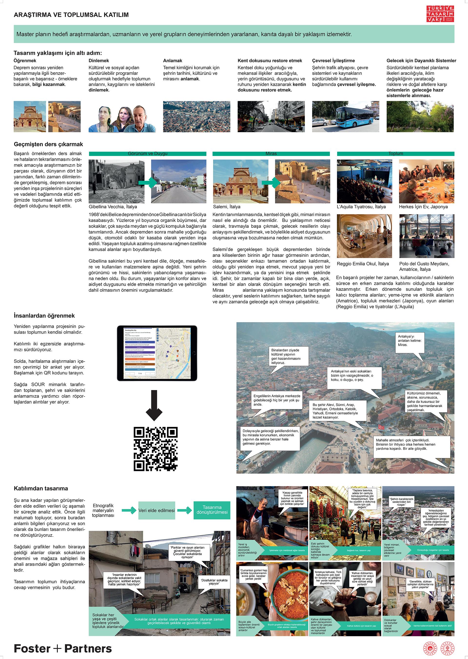
Community Engagement
As part of our research, we looked at examples of post-earthquake reconstruction from different time periods, and maturity levels of reconstruction projects around the world. In order to learn from successful examples and not repeat mistakes, these reviews showed that community engagement is vital. We have analyzed the data obtained from the interviews conducted so far in a three-step process. First, we collect data, then extract relevant information, and finally convert it into design recommendations. This ensures that the design will respond to community needs. Architectural typologies, streetscapes, common public spaces, and community habits reflect the richness and diversity of Antakya’s culture and history. And we want to understand from first-hand experience, how these spaces
were used.
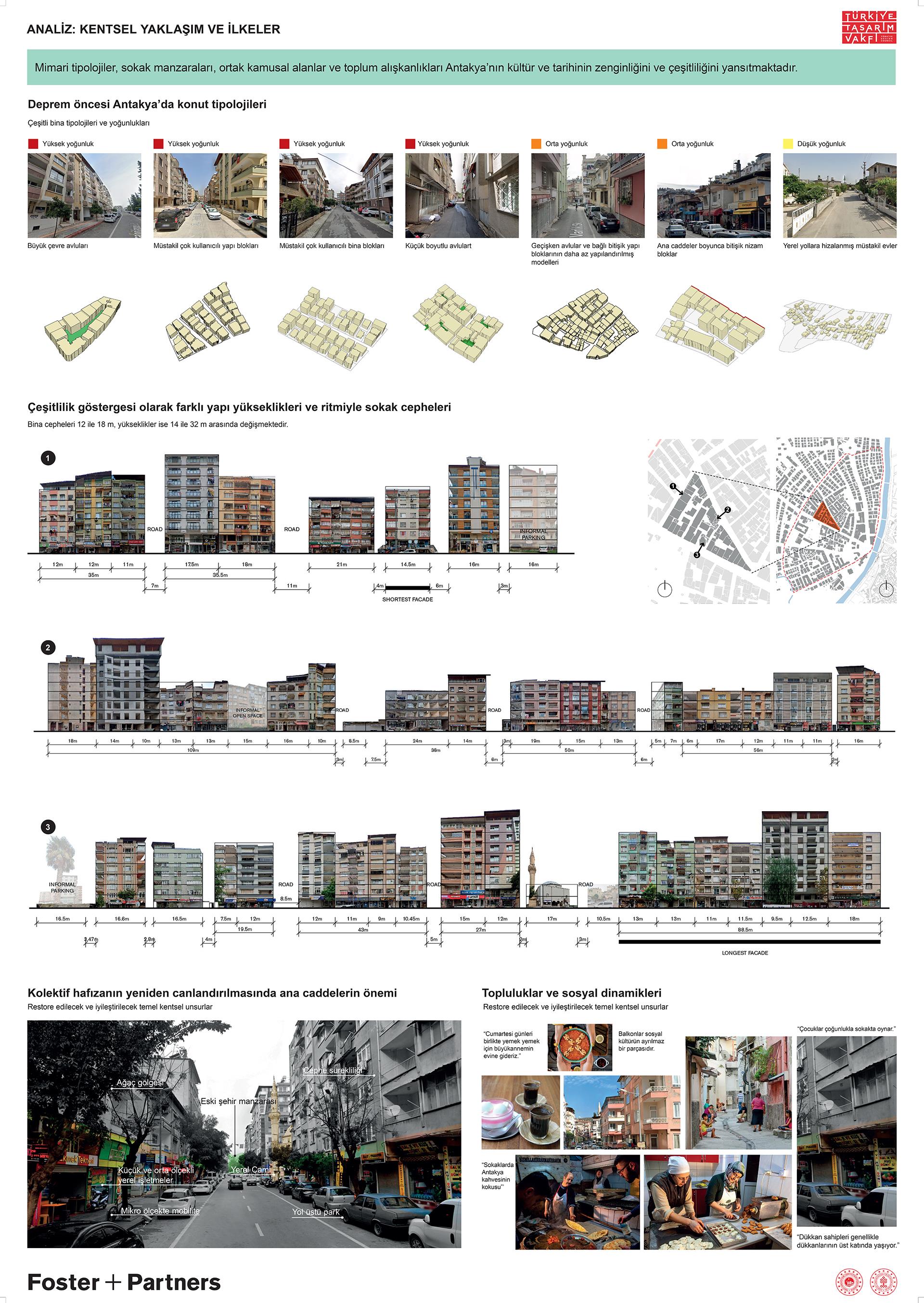
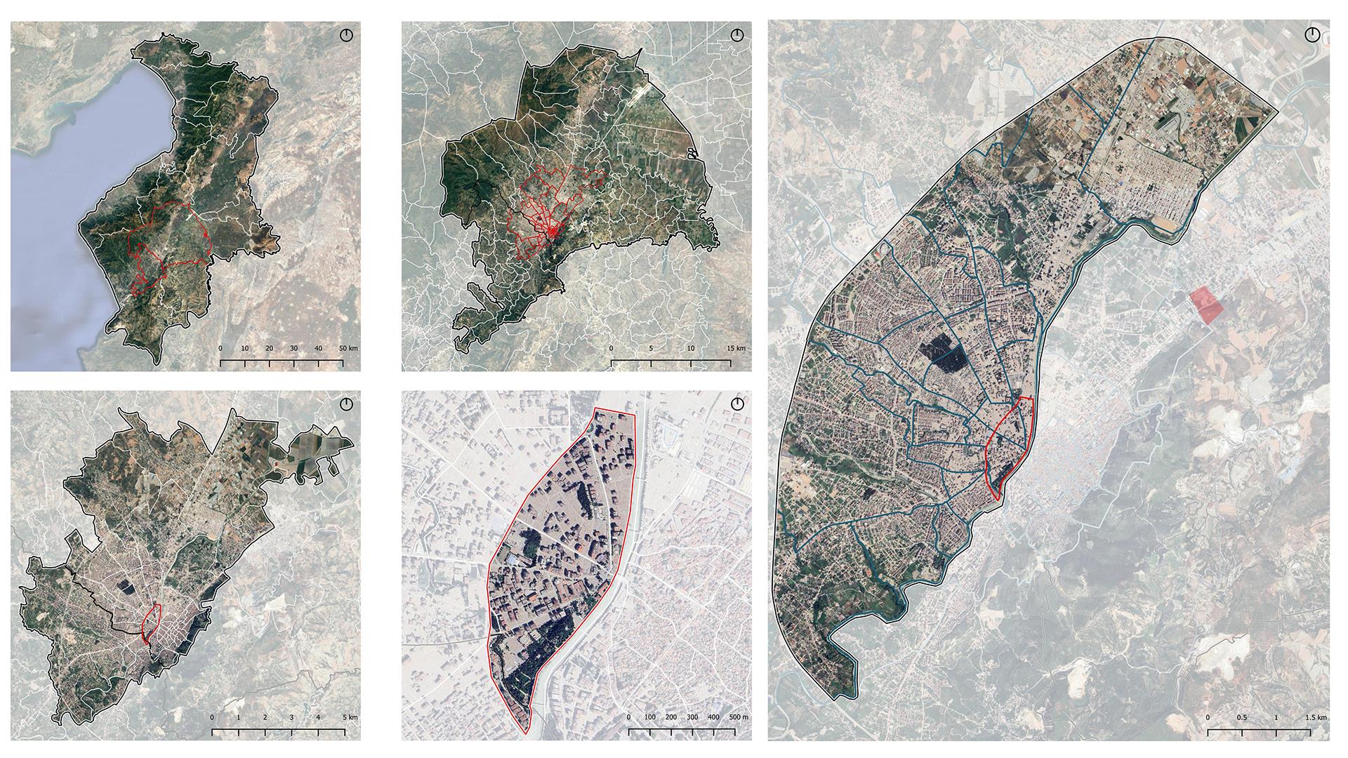
Pre-earthquake Condition of Antakya’s Urban Environment
Our analysis of pre-earthquake Antakya’s urban environment revealed several key findings. The city faced significant challenges due to its vulnerability to flooding, particularly impacting informal settlements located in flood-prone areas. Despite this, Antakya exhibited commendable features such as dense street network, permeable urban fabric and a human scale of the urban environment.
However, one notable concern was the uneven distribution of open spaces within the urban plan. While Antakya boasted significant green areas, including major parks primarily clustered in the core area, these spaces were not uniformly accessible across the city.
In summary, while Antakya showcased strengths in urban design, addressing challenges like flooding and the unequal distribution of open spaces will be essential tasks for enhancing the city’s resilience and livability in the future.
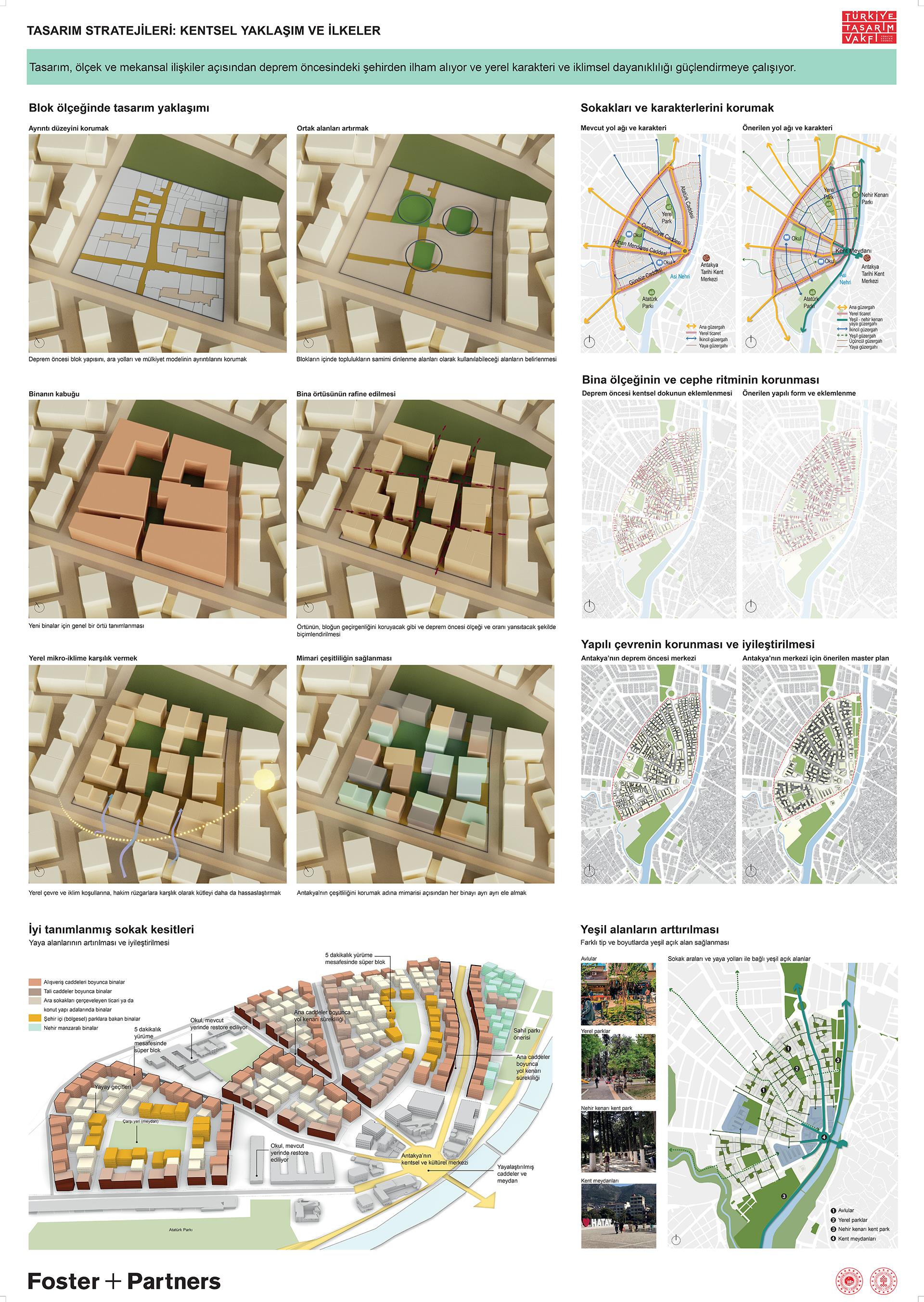
City-wide Strategies
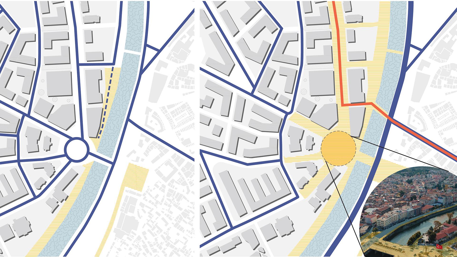
Our proposed strategies for improving Antakya’s urban environment encompass several key initiatives. Firstly, we advocate for a comprehensive land use plan that takes into account the city’s floodplain pattern, allocating suitable areas for future rebuilding to mitigate flood risks effectively. This approach ensures safer development in vulnerable zones while promoting sustainable urban growth.
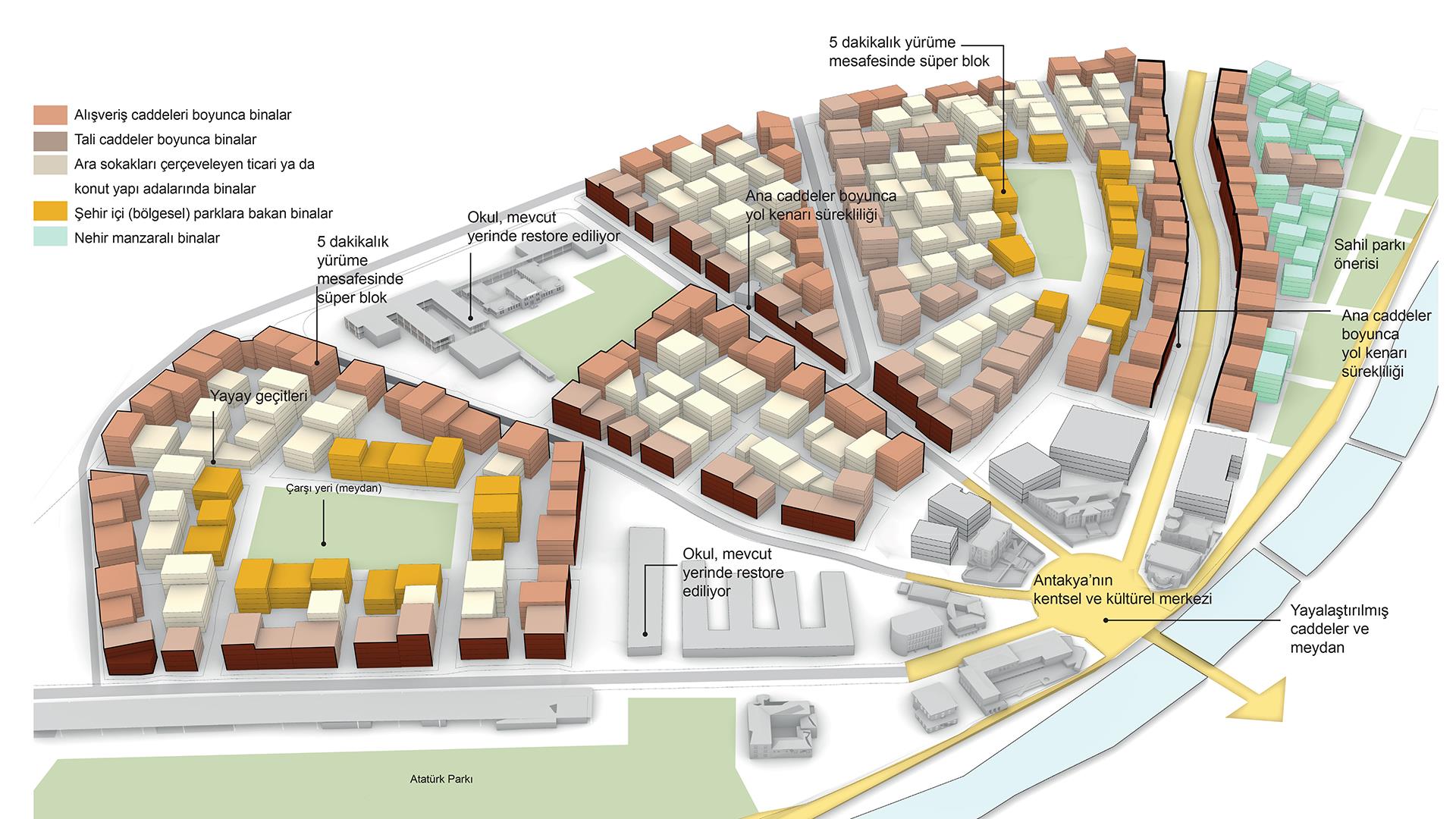
We prioritize enhancing the city’s transportation infrastructure by improving road hierarchy and retaining the existing network structure. Additionally, by concentrating commercial centers within walking distances from residential areas, we aim to reduce dependency on vehicular transport and promote a more pedestrian-friendly urban environment.
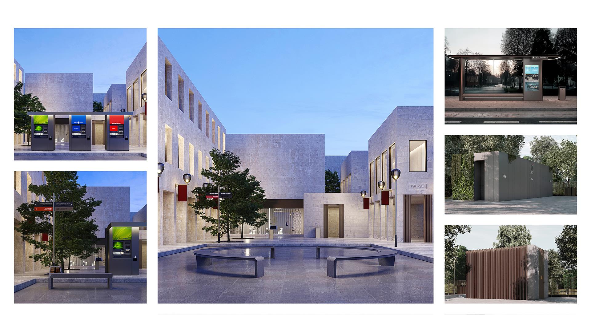
Moreover, our plan includes the introduction of a network of community- oriented, pedestrian-friendly routes. These routes will connect social amenities, fostering community engagement and enhancing mobility within the city. Lastly, our open space strategy prioritizes diversity of programming and fair distribution of green spaces throughout Antakya, ensuring that parks and recreational areas are accessible to all residents and enhancing the overall quality of life in the city.
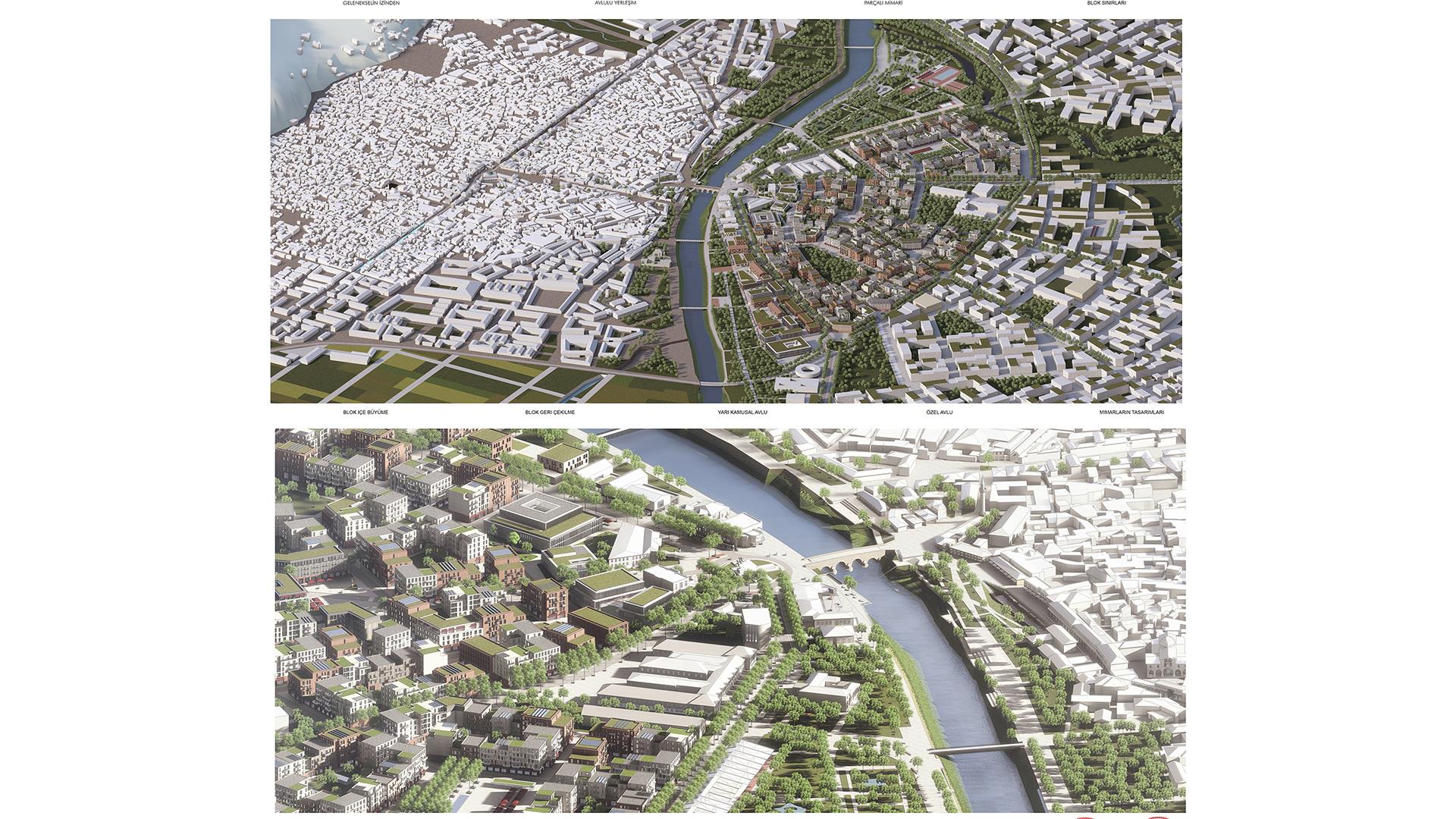
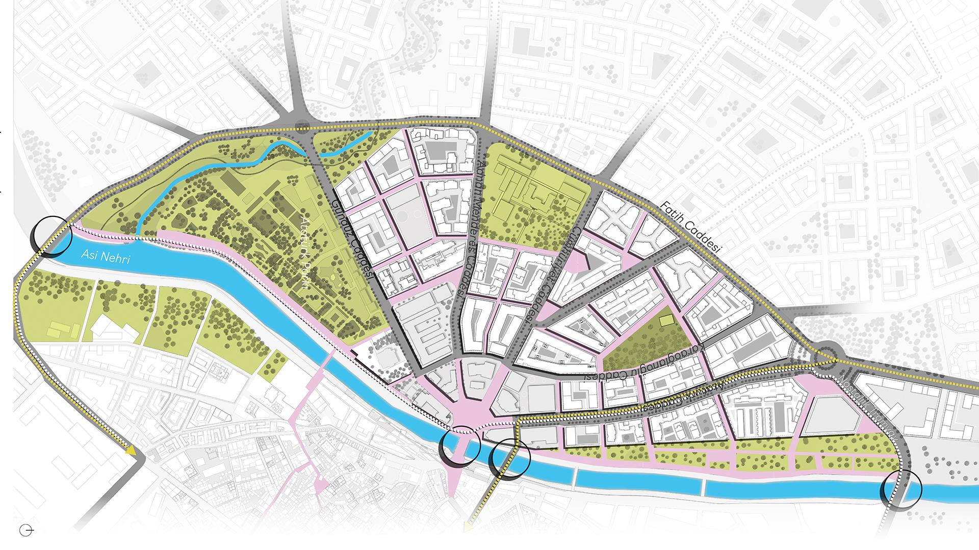
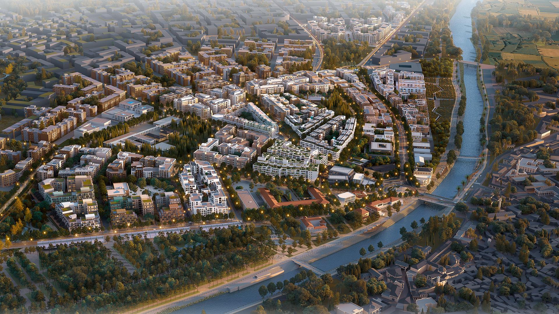
Planning Levels: District Layering
Creating 12 districts based on walkability, where each district is defined by either a high street (primary street) or waterbed.
Thus, every district can be centered around a retail and commercial activity and public transport availability. Waterfront adjacency, on the other hand, capitalize on scenic views and recreational opportunities along the Asi river and a variety of streams.
Additionally, incorporating green spaces and public plazas within each district enhances walkability and fosters vibrant communities. This approach not only encourages walking and micromobility but also creates appealing destinations that contribute to the overall livability of the city.